- Region
- Águilas
- Alhama de Murcia
- Jumilla
- Lorca
- Los Alcázares
- Mazarrón
- San Javier
-
ALL AREAS & TOWNS
- AREAS
- SOUTH WEST
- MAR MENOR
- MURCIA CITY & CENTRAL
- NORTH & NORTH WEST
- TOWNS
- Abanilla
- Abarán
- Aguilas
- Alamillo
- Alcantarilla
- Aledo
- Alhama de Murcia
- Archena
- Balsicas
- Blanca
- Bolnuevo
- Bullas
- Cañadas del Romero
- Cabo de Palos
- Calasparra
- Camping Bolnuevo
- Campo De Ricote
- Camposol
- Canada De La Lena
- Caravaca de la Cruz
- Cartagena
- Cehegin
- Ceuti
- Cieza
- Condado de Alhama
- Corvera
- Costa Cálida
- Cuevas De Almanzora
- Cuevas de Reyllo
- El Carmoli
- El Mojon
- El Molino (Puerto Lumbreras)
- El Pareton / Cantareros
- El Raso
- El Valle Golf Resort
- Fortuna
- Fuente Alamo
- Hacienda del Alamo Golf Resort
- Hacienda Riquelme Golf Resort
- Isla Plana
- Islas Menores & Mar de Cristal
- Jumilla
- La Azohia
- La Charca
- La Manga Club
- La Manga del Mar Menor
- La Pinilla
- La Puebla
- La Torre
- La Torre Golf Resort
- La Unión
- Las Palas
- Las Ramblas
- Las Ramblas Golf
- Las Torres de Cotillas
- Leiva
- Librilla
- Lo Pagan
- Lo Santiago
- Lorca
- Lorquí
- Los Alcázares
- Los Balcones
- Los Belones
- Los Canovas
- Los Nietos
- Los Perez (Tallante)
- Los Urrutias
- Los Ventorrillos
- Mar De Cristal
- Mar Menor
- Mar Menor Golf Resort
- Mazarrón
- Mazarrón Country Club
- Molina de Segura
- Moratalla
- Mula
- Murcia City
- Murcia Property
- Pareton
- Peraleja Golf Resort
- Perin
- Pilar de la Horadada
- Pinar de Campoverde
- Pinoso
- Playa Honda
- Playa Honda / Playa Paraíso
- Pliego
- Portmán
- Pozo Estrecho
- Puerto de Mazarrón
- Puerto Lumbreras
- Puntas De Calnegre
- Region of Murcia
- Ricote
- Roda Golf Resort
- Roldan
- Roldan and Lo Ferro
- San Javier
- San Pedro del Pinatar
- Santiago de la Ribera
- Sierra Espuña
- Sucina
- Tallante
- Terrazas de la Torre Golf Resort
- Torre Pacheco
- Totana
- What's On Weekly Bulletin
- Yecla


- EDITIONS:
 Spanish News Today
 Alicante Today
 Andalucia Today
article_detail
Outlying districts of Fuente Álamo: Las Palas
Las Palas lies in the south-west of the municipality of Fuente Álamo
Las Palas is a "pedanía" or outlying district of Fuente Álamo and is located in the south-west of the municipality.
Its name is derived from the abundant "palas" (prickly pears) which grow in the area, and these have served a multitude of purposes over the centuries: as hedging, to keep animals and unwelcome visitors out, as corrals to keep animals in, and also as makeshift urinals as they have a property which absorbs urine!
At one time the locality was known as the "camino de los molinos del campo" ("country mills road") due to the numerous abandoned flour mills nearby, especially on the road between Las Palas and Fuente Álamo.
Las Palas in Roman times
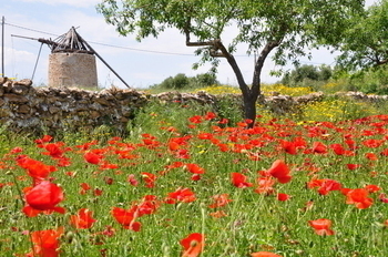 The Campo de Cartagena was very important to the Romans during their years of occupation from 209 BC to around the end of the second century AD, both as a source for crop production and as a source of natural minerals and resources. The Romans used existing trade routes which ran along the Mediterranean coasts, stamping their own authority by building roads along the most important of them.
Among these was the road which later became the Camino Real, linking Cartagena, Lorca and Jaén. and along the route settlements sprang up, in the areas known as Campo Nubla, La Manchica, Finca Almendros, Cabezo de la Cebolla, Fuentes del Mingrano, La Pinilla, El Raal and Rambla de la Orilla.
El Raal, by the Fuente Álamo road, was also subsequently occupied by Moorish settlers and many pieces of Roman and Islamic ceramics, as well as structural and decorative elements of buildings , have been found in this location.
Las Palas after the Romans
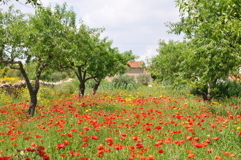 Following the departure of the Romans, Cartagena was occupied by a succession of Goths and Visigoths before reaching relative stability under the Moorish occupation in the mid 8th century, and this lasted until the occupancy of Christian sovereigns in the 13th century.
As Murcia passed from Moorish to Christian control in 1243, an agreement was reached which permitted the Mors, who formed the majority of occupants farming the land, to stay, although many were later evicted following an uprising against Alfonso X in 1266.
Although attempts were made to entice Christian settlers, the area suffered from de-population in the 15th century.
Mediaeval records are patchy, but mention is made in documents from 1463 and 1532 of the well at Pozo del Tío Andreo, which was used as a boundary marker between Cartagena and Lorca. At this point the land and well were owned by the Council of Lorca, and were used to provide water and pasture for livestock: the well still exists in the town of Las Palas today.
During the 16th century concessions were offered as part of the repopulation initiative to try and bring in settlers. The area and the nearby pasture at Campo Nubla, allied with the large number of natural freshwater wells and springs in the hills nearby, made this an important area for pastoral grazing, and important land concessions were granted to various individuals from Lorca and Librilla to till and work the land, constructing irrigation ditches and growing crops.
 Eventually the town grew up alongside the well.
Next to the Rambla de La Azohía, on the road to Tallante, there are still the remains of a 16th-century fortified tower which was built to protect the recently repopulated lands from possible pirate attacks and guarantee their newfound prosperity.
By this point, the Moors had been expelled from Spain altogether and Berber pirates from Africa had become a real menace, attacking the Murcian coastline to steal crops and even villagers, to sell them in African slave markets, so watchtowers were an essential part of life in areas near to the coast.
Although Fuente Álamo attained the status of "villa" in 1700, Las Palas still belonged to Lorca and Cartagena, and was administratively divided in two when the two cities defined their borders using the Pozo del Tío Andreo in 1788.
In 1787 there were about 340 inhabitants, but the next few years saw a severe drought followed by outbreaks of typhoid fever and malaria, in the face of which many of the inhabitants fled to country houses in the farmlands in an attempt to avoid the deadly diseases.
When the municipality of Fuente Álamo became independent in 1820, Las Palas was included within its boundaries, and in 1836 had 105 registered inhabitants according to the municipal taxpayers roll.
During the 20th century the population and resources of the town both grew. In 1917 the "Fiesta del Árbol" was held, with the first performance by the town band, under the baton of Jesús Lorca, a composer of light operas ("zarzuelas"). In 1929 there were two schools for the children of the town and the neighbouring countryside, and after the Civil War a theatre was inaugurated.
In 1953 a bus route linked Las Palas to Murcia.
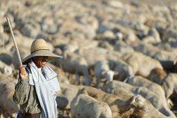
Today Las Palas is essentially a farming community, although the crops have changed from dry field crops such as olives and almonds to livestock, with chickens and pigs important sources of revenue. Irrigated farming techniques have also enabled agriculturalists to add new crops to their production, and potatoes, broccoli, melons and lettuces are all important export crops.
Apart from agriculture there is little to provide employment, but there is work in nearby towns such as Mazarrón and Fuente Álamo.
Las Palas has several shops, a supermarket, bakery, estate agents, bank, a small weekly market, bars and restaurants and a medical centre.
Centro Cultural Las Palas
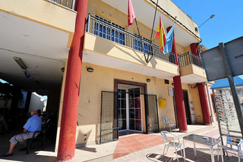 The Centro Cultural de Las Palas is a two-storey building which has been refurbished to give easier access to all citizens. Included are a kitchen, toilets, a storeroom, a lounge and a café.
There is also a fairground area, football pitch and an open-air swimming-pool, with changing rooms and an adjoining garden area.
Address: Casa de la Cultura, c/ Mayor, s/n
30334 Las Palas (Fuente Álamo)
Tel: 968 159 210
Parroquia San Pedro Apostól, Las Palas
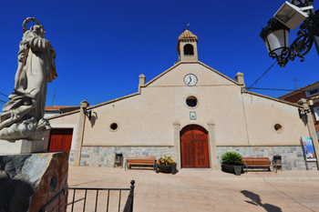 The parish church is dedicated to Saint Peter, although it is the image of the Virgen de la Purísima who welcomes visitors to the church externally.
The church is a simple building, with a brickwork façade setting off the belltower, which containing a bell donated to the village by General Bastarreche, whose image is in the Plaza Bastarreche in Cartagena.
The church has no Camarín (a raised alcove in which the image of the patron normally resides,) so in Las Palas he looks out directly from the Altar Mayor. The sculptures are all new, having been purchased by the residents following the destruction of the originals during the Civil War. The existing Saint Peter dates from 4th August 1940.
Fiestas in Las Palas
The patron saint of Las Palas is San Pedro Apóstol, and the fiestas in his honour are celebrated on 29th June. All types of cultural and leisure activities are held in the ten days around the key date, and the village is festooned with decorations for this period.
Location of Las Palas
Click for map, Las Palas, Fuente Álamo , Murcia
Buying property in Las Palas
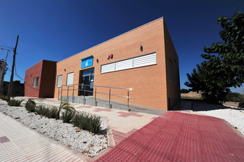 In the first years of the 21st century Las Palas became extremely popular with British expats, due to the presence of the Old Farmhouses estate agency in the village. They were attracted by the many country properties which in the area, many of them reformed, and the area is just a few minutes from the coast and the beaches of Mazarrón. On the other hand, it is still quintessentially Spanish, despite the large expat population of nearby Mazarrón.
The area tends to attract those who like the security of being near an English-speaking area but do not want to be in it and are still seeking rural Spain.
Infrastructure connections are good: Corvera airport is around 30 minutes away by car and it is very close to the AP-7 motorway.
Hypermarket shopping is available in Cartagena (30 minutes) and there are numerous supermarkets in Fuente Álamo and Mazarrón.
article_detail
Contact Murcia Today: Editorial 000 000 000 /
Office 000 000 000

