- Region
- Águilas
- Alhama de Murcia
- Jumilla
- Lorca
- Los Alcázares
- Mazarrón
- San Javier
-
ALL AREAS & TOWNS
- AREAS
- SOUTH WEST
- MAR MENOR
- MURCIA CITY & CENTRAL
- NORTH & NORTH WEST
- TOWNS
- Abanilla
- Abarán
- Aguilas
- Alamillo
- Alcantarilla
- Aledo
- Alhama de Murcia
- Archena
- Balsicas
- Blanca
- Bolnuevo
- Bullas
- Cañadas del Romero
- Cabo de Palos
- Calasparra
- Camping Bolnuevo
- Campo De Ricote
- Camposol
- Canada De La Lena
- Caravaca de la Cruz
- Cartagena
- Cehegin
- Ceuti
- Cieza
- Condado de Alhama
- Corvera
- Costa Cálida
- Cuevas De Almanzora
- Cuevas de Reyllo
- El Carmoli
- El Mojon
- El Molino (Puerto Lumbreras)
- El Pareton / Cantareros
- El Raso
- El Valle Golf Resort
- Fortuna
- Fuente Alamo
- Hacienda del Alamo Golf Resort
- Hacienda Riquelme Golf Resort
- Isla Plana
- Islas Menores & Mar de Cristal
- Jumilla
- La Azohia
- La Charca
- La Manga Club
- La Manga del Mar Menor
- La Pinilla
- La Puebla
- La Torre
- La Torre Golf Resort
- La Unión
- Las Palas
- Las Ramblas
- Las Ramblas Golf
- Las Torres de Cotillas
- Leiva
- Librilla
- Lo Pagan
- Lo Santiago
- Lorca
- Lorquí
- Los Alcázares
- Los Balcones
- Los Belones
- Los Canovas
- Los Nietos
- Los Perez (Tallante)
- Los Urrutias
- Los Ventorrillos
- Mar De Cristal
- Mar Menor
- Mar Menor Golf Resort
- Mazarrón
- Mazarrón Country Club
- Molina de Segura
- Moratalla
- Mula
- Murcia City
- Murcia Property
- Pareton
- Peraleja Golf Resort
- Perin
- Pilar de la Horadada
- Pinar de Campoverde
- Pinoso
- Playa Honda
- Playa Honda / Playa Paraíso
- Pliego
- Portmán
- Pozo Estrecho
- Puerto de Mazarrón
- Puerto Lumbreras
- Puntas De Calnegre
- Region of Murcia
- Ricote
- Roda Golf Resort
- Roldan
- Roldan and Lo Ferro
- San Javier
- San Pedro del Pinatar
- Santiago de la Ribera
- Sierra Espuña
- Sucina
- Tallante
- Terrazas de la Torre Golf Resort
- Torre Pacheco
- Totana
- What's On Weekly Bulletin
- Yecla


- EDITIONS:
 Spanish News Today
 Alicante Today
 Andalucia Today
article_detail
A history of San Pedro del Pinatar
The history of San Pedro del Pinatar is inextricably linked to its geography
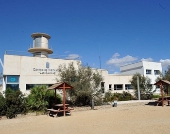
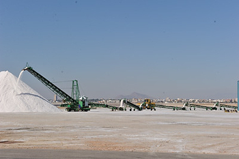 Situated between the Mar Menor, the largest natural saltwater lake in Europe, and the Mediterranean, its waters are rich in fish, natural mineral mud baths, the natural salinas park area and salt flats.
Although no prehistoric remains have been uncovered in San Pedro del Pinatar itself, remains found in Las Amoladeras, near to Cabo de Palos show that the area was inhabited in the 3rd millennium BC, before the Bronze Age, the Paleolithic era.
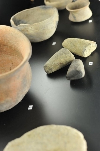 At that time, 5000 years ago, the Mar Menor was still an open bay, and the inhabitants gathered seafood, fished and hunted in the forests of the Campo de Cartagena, where cypresses and holm oaks spread right to the shore. Using simple structure boats they sailed from island to island, searching for food, evidence of which remains in the flint tools discovered.
The next civilisation to leave behind evidence of their presence were the Phoenicians, a great trading nation who plied the Mediterranean coastline, trading raw materials for finished products.
(Click for more information about the Phoenicians and their presence in Murcia.)
Ceramics of Phoenician origin, dating to 600-700 BC, have been widely uncovered in various sites along the Murcian coastline, and the waters just off the La Manga coast bear witness to their presence in the form of the Bajo de la Campana wreck, an important shipwreck which is still under excavation. The Phoenicians are known to have traded raw minerals and ores, dyes extracted from seashells, cloth, ceramics, metalwork, spices, esparto and glass, exchanging luxury goods for raw materials, with the Iberians ( Click Iberians) who were living here at this point in time.
The Greeks were also trading along this coastline, testament being some of the fine Greek ceramics which can be found in the region´s museums.
At this point in history, El Pinatar was an important and wealthy trading port.
The Romans in El Pinatar
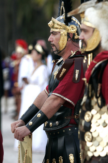 The complicated power struggle in the Mediterranean basin involving the Romans and Carthaginians lead to the gradual displacement of the latter, and groups drifted along the Mediterranean coastline, slowly colonising the lower reaches of the Mediterranean and Spain. It´s not known when the first settlers arrived in this area, although there were certainly Carthaginians in Spain during the 6th century BC, and as the struggle for their survival as a nation intensified, the skirmishes between Carthage and Rome during the Punic Wars between 264 and 146 BC certainly impacted on this area.
Cartagena came under Carthaginian control in 227BC, but their domination was short lived as the Romans saw the possibilities of the silver and lead mines and the salting industry and took advantage of the absence of Hannibal to take the city. ( See History of Cartagena.) It is believed that the young general Publius Cornelius Scipio, who eventually defeated the Carthaginian forces in 209 BC, made his last camp here in El Pinatar ( the name by which San Pedro del Pinatar was formerly known) before besieging and taking Qart Hadast.( Cartagena)
Eventually Rome dominated the whole of the Mediterranean, and they set about exploiting the natural resources of the area.
El Pinatar became an industrial villa, and the Romans amplified the salt flats to extract salt, and carry out a number of processes relating to the salting and processing of fish to make the legendary “garum” sauce from locally caught fish which was exported across the Empire. ( click garum.)
El Pinatar was well connected, the Via Augusta, a great trading road constructed by the Romans which ran from Cádiz to Narbonne, passing through Cartagena and Tarraco (Tarragona), ran through San Pedro del Pinatar.
As an important industrial site and port, villas were built in the area, one which can be visited by the public being that of Los Plazas-La Raya in the pedanía of El Mojón. The original excavations here uncovered a wealth of important items, as well as a hoard of republican denarii ( money) found at La Grajuela, some of which can be seen at the municipal Museum.
Other discoveries highlight the volume of sea traffic which was involved in the production and exportation of salt fish products, with large quantities of ceramic shards and salt fish production tanks discovered at various points at San Ferreol (near la Playuela,) and Punta de Algas, opposite La Manga del Mar Menor.
The Romans most important legacy however, are the Salinas de Coterillo to produce salt, a valuable commodity which was shipped across the Empire. These later became the property of the Crown of Spain, before becoming privately owned businesses.
The Moors and “Encañizadas” Fishing
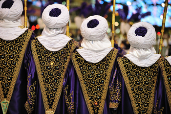 By the 5th century the Roman Empire had fallen apart, and in 713AD the Moors arrived in the Mar Menor area. This area is shown on maps as being called La Albufera at this point.
They introduced the “Encañizadas” fishing technique to catch mullet and other native species of fish in the channels which cut into the coastline in the area. This technique, which is still used today, consists of taking advantage of the migratory instincts of some species of fish, and building labyrinths which they can find their way into, but not out of.
The Christian Reconquista of La Albufera, 13th century
The Moors remained in power between the 8th and 13th century when the Christian Reconquist took place.
In the early 13th century, Spain was dominated by two powerful Catholic Kingdoms, Castile y León and Aragón, with just a small Moorish presence in the south.
As the Catholic forces swept south, a treaty called the Capitulations of Alcaraz effectively ended Moorish rule
In 1243, resulting in the peaceful submission of the Kingdom of Murcia, which became a protectorate of Castile and León, and the Emir of Murcia a vassal of the King.
Fernando III of Castile came to Murcia to entrust his son, the young Prince Alfonso, with governing the territory gained .
Prince Alfonso occupied the countryside of Murcia and the city of Cartagena, and since Murcia at this time encompassed the territory of La Albufera and the coastline, the area of El Pinatar was included.
On his death in 1252, Fernando of Castile was succeeded by Alfonso, to become Alfonso X, known as El Sabio, the wise, who divided the region south of the mountains into two jurisdictions, corresponding to Murcia and Cartagena.
San Pedro del Pinatar: on the Aragón-Castile border
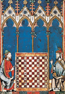 In Mediaeval Spain, land was power, and the problem of defining the dividing line between the kingdoms of Castile and Aragón proved a difficult one for Fernando IV of Castile, grandson of Alfonso X who inherited the throne after the death of his second son, Sancho, and Jaime II of Aragón.
In 1305 they decided to create a border across the Campo de Cartagena, ending in the town of El Pinatar, establishing a marker on a rocky outcrop in the sea which would from then on be known as El Mojón.
The Vereda Real (Royal Path) followed the boundary and joined the Vereda Hilada, which is the boundary between San Pedro del Pinatar and San Javier. These Veredas were used to herd livestock from the mountains of Cuenca to the winter pastures on the plains of La Albufera, and there are several traces of them in the region, at known watering points and springs.
The son of Ferdinand IV was Alfonso XI, whose Libro de Montería, written in 1340, tells us something of what San Pedro was like in the Middle Ages, describing it as heavily forested and a good boar-hunting ground in winter.
Towards the end of the Medieval era, the last remaining Moorish Kingdom of Spain was based in Granada, and rebelled against the Catholic armies.
Their forces reached Murcia and Cartagena, and got as far as El Pinatar, where there was a battle after which they had to retreat to the Guadalentín valley.
They made another attack later, but were again defeated, San Pedro del Pinatar being the last location in which a Moorish attack of any significance took place before the completion of the Christian Reconquista in 1492, the last Moorish ruler, Muhammed XII of Granada defeated, and the Catholic Monarchs, Isabella I of Castile, married to Ferdinand II of Aragón, uniting Spain for the first time.
Although documentary evidence is scarce, Chronicles of the time mention San Pedro del Pinatar as being one of the ports of Murcia where wheat 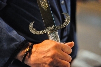 was imported to feed the city, and whose Council administered the fishing activities of San Pedro. At the end of the medieval period the town was prospering and its population was rising.
The Threat of Pirates in the 16th and 17th centuries
However, the tranquility of life on the coast was shattered by the raids of Berber pirates. With the Moors expelled from Spain, they turned their attention to raiding it from the coasts of Africa.
The easy access to La Albufera made it possible for them to plunder the area without much trouble, and to defend themselves the population erected watchtowers along the coastline.
In 1592 Fernando II announced by Royal Charter his intention to construct a defensive tower in El Pinatar, between the towers already in place at La Forada (Horadada) and San Miguel del Estacio, in order to strengthen the defence systems of the area. The Tower of Pinatar was built in 1602, and was armed and manned until the 18th century.
The area, however, in line with much of the murcian coastline suffered a decline in population as the pirates wreaked havoc amongst the settled population.
The First Chapel of San Pedro del Pinatar
In the 17th century, there was a proliferation of chapels in the countryside of Murcia, mainly due to the missionary activities of the Franciscans, one of which was built at El Pinatar, dedicated to San Pedro, Saint Peter.
From then on El Pinatar was known as San Pedro del Pinatar.
San Pedro del Pinatar as part of the Duchy of Berwick
 When the Spanish War of Succession (1700-13) broke out, Murcia took the part of Felipe V, and the supporters of Archduke Carlos of Austria attacked Cartagena and the ports in 1706. The area fell to the British allies of the Archduke, until the Duke of Berwick, fighting for the Borbons, and the concept of uniting France and Spain under one Borbon ruler, won it back and was rewarded with land, and records show that the land given to him must have included San Pedro del Pinatar..
This happened at the Battle of Almansa in 1707, and the main park built since in San Javier was named the Parque Almansa to commemorate the victory. The Battle has been described as "probably the only Battle in history in which the British forces were commanded by a Frenchman, and the French by a Briton."
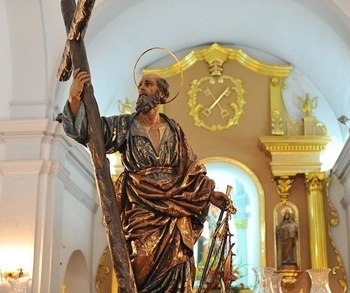 In the middle of the 18th century various reforms were carried out in the Church: a bell was installed, three baroque altarpieces were built and the image of Saint Peter, sculpted by Francisco Salzillo, was acquired. The last years of the period were quiet and prosperous, as the Berber attacks became less frequent and the town grew in terms of population and economy. Carlos IV awarded the town its own Feria in June, to coincide with the feast day of the its patron saint, and the town register shows that the population doubled between 1771 and 1798.
The 19th century saw a series of natural disasters in the south-east of Spain, including the Torrevieja earthquake, which almost totally destroyed the town of Almoradí, and caused heavy damage in San Pedro del Pinatar.
Cholera also ravaged the populace, but San Pedro remained free of the disease, and many families from Murcia and Cartagena acquired property in the town. This marked the beginnings of the transformation of the San Pedro into a summer holiday resort.
The Municipality of San Pedro del Pinatar
San Pedro del Pinatar became an independent municipality on 16th September, 1836, with José Imbernón Ruiz as the first Mayor. The Maritime Customs Office was opened in 1857, and El Mojón was designated as a “quay/port equipped for coastal trade”.
On 16th June, 1869, San Pedro del Pinatar was deprived by law of its salt monopoly, and the flats were put up for sale. They were bought by 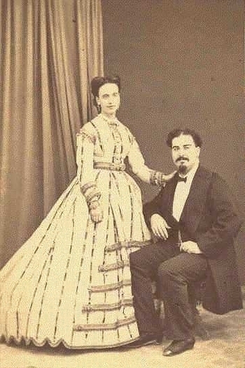 Manuel García Coterillo, after whom they are now named, and later they were acquired by a group of Murcian businessmen under the name of Mancomunidad de Salinas Marítimas de San Pedro del Pinatar. They now belong to Salinera Española.
Social Splendour at the end of the 19th Century
By the end of the 19th century most of the inhabitants were dedicated to agriculture, fishing and saltworks, and the area was a country estate belonging to Pedro Pagán y Ayuso, Mayor of Murcia in 1874.
He built a summer retreat to which he invited intellectuals and politicians to spend summer evenings at the literary soirées he organized with his wife, Leonor Guerra, the darling of Murcia’s intelligentsia, famous for her literary salons in the capital.
Their house at San Pedro became THE place to visit and visitors included such prestigious figures as Cánovas del Castillo (president of Spain 1875-76), the Baron of Benifayó and Emilio Castelar (president 1873-74).
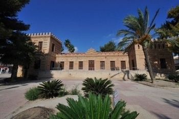 In the 19th century other wealthy families from Murcia began to build their own summer houses on the coast nearby, and by the end of the 19th century La Puntica and La Junquera were dotted with properties belonging to wealthy Murcians, including Emilio Castelar (after whom one of the main streets in the town is named), the Baron of Benifayó, the industrialist Manuel García Coterillo, Doctors Perpén and Ferrero, the descendents of the Conde de Floridablanca, The Marquis of Ensenada, the Countess of Tetuán, and a long list of social celebrities of the time.
The politician and renowned orator Emilio Castelar y Ripoll, who had been president of the Executive Power of the First Republic, died in San Pedro del Pinatar in 1899 while staying at the Villa San Sebastián. This was the house owned by the Servet-Spottorno family, nowadays known as the Casa del Reloj, and is now a restaurant. Just a few months before, the Julio Falcó d’Adda, the Baron of Benifayó, of the House of Savoy, had died in his palatial home “Las Esperanzas,” now a museum.
First half of the 20th Century
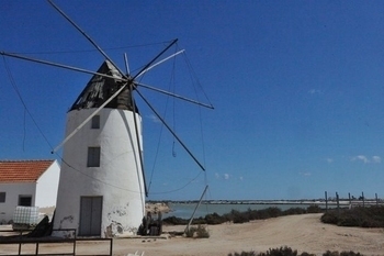 In the second half of the 19th century the population grew from 1,650 to 2,650, mainly employed in traditional occupations such as fishing and agriculture, although the latter was made more difficult by the lack of available land and the shortage of water. In order to alleviate the problems water wheels were built to make the most of subterranean supplies.
The salt flats had been a source of employment since time immemorial, and there are still remains of the mills of Quintín and La Ezequiela, which used wind power to carry water from the Mar Menor to the salt flats.
In 1911 the Balneario de Floridablanca was built, encouraging middle class families to join the wealthy in their summer sojourns in San Pedro del Pinatar.
However, unrest and the Civil War which followed rocked Spain between 1936-39, and during the early days, the church of San Pedro was set on fire, most of the precious sculptures it contained destroyed. Following the war, the Church underwent restoration and the sculptures were replaced with newer images.
The 60’s Boom and San Pedro del Pinatar Today
 In the 1960’s San Pedro del Pinatar started to become the tourist town it is today, with a vastly expanded economy and many jobs created in the construction and services sectors.
This caused a huge increase in population: from 6,000 to 12,000 between 1970 and 1991, to 22,000 in 2007.
As well as a fishing port, San Pedro del Pinatar is now one of the major tourist resorts of the Costa Cálida, and the population figures include over 5,000 foreign nationals.
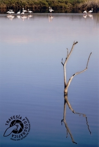
The fishing fleet plies the waters of the Mediterranean and the Mar Menor, which are rich in sea bream, sole and mullet. The salt flats continue to provide income, and have been a Regional Park since 1985, where both the landscape and the flamingoes provide perfect photo opportunities. Agriculture, fishing, industry, salt production and tourism all contribute to the economy of the municipality, tourists attracted by the warm climate, sandy beaches, safe bathing in the Mar Menor, mineral laden muds offering health tourism opportunities, and the natural beauty of the Salinas Regional park.
Contact Murcia Today: Editorial 000 000 000 /
Office 000 000 000


